
September 2023, Vol. 250, No. 9
Features
Collaboration Helps Balance Public, Owner Pipeline Project Interests
By Chris Siok, PE, Department Manager, and Greg Smith II, Associate, Section Manager, Rights-of-Way, Burns & McDonnell
(P&GJ) — For linear projects such as pipelines, dealing with the unexpected should be expected. The best preparation for these surprises is to partner with a team structured for close collaboration between the real estate and engineering disciplines as well as everything in between.
At the end of the day, communication and close working relationships with every specialty discipline is the formula needed for a successful project.
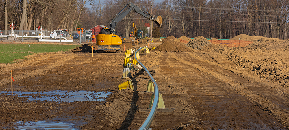
Pipelines today often present as much – and often more – complexity than any other type of linear project, particularly if they are large new greenfield transmission assets that may span multiple jurisdictions and require acquisition of dozens of property parcels.
Not only will the right-of-way (ROW) professionals need to be heavily involved during early planning, early-stage involvement by the engineering disciplines will be prudent as well.
Though there are multiple contracting approaches for engaging the services of these third-party disciplines, a project that opens the way for a collaborative team to perform the necessary scopes can enable the flexibility needed to adjust and react to any unanticipated hurdles, which ultimately improves project performance.
Common Picture
Identifying a preferred pipeline corridor often starts with a desktop review of the physical environment and real estate properties that lie along the route. Though this is a preliminary step that requires subsequent on-site inspections and surveys, a detailed routing study can help identify fatal flaws with the selected route, such as restricted access corridors from state transportation departments, significant historical or cultural sites, areas with potential environmental contamination, or special land use protections.
These studies provide the supporting data that will be needed to obtain rights-of-way and easements as well as to identify the purchase options that will be needed to acquire land, or even to defend a condemnation action if that becomes necessary. The data provided by the study also supports the work of the engineering staff as they develop project boundaries and design various scope packages.
Because permissions to access properties vary by state, documenting special provisions that may require access is an especially important step. On-site visits are key actions that can help surface landowner requests or concerns, which can be more easily accommodated at an early design stage.
Not only will this save costs, but it can also help identify and avoid any potential impasses that could delay or even force a project to follow a more costly route. By obtaining as much early information as possible, the land team can serve as a valuable liaison between project stakeholders – from property and project owners – to the engineering, legal and procurement professionals.
This common operational picture and early engagement can be key to minimizing any hiccups down the road that may require a costly new design or more property acquisitions.
The ROW team sets out immediately to obtain as much information as possible that can assist with the design and placement of both below-ground pipeline infrastructure and above-ground assets such as valves, meter and regulation facilities, and pump or compressor stations.
Information on locations where horizontal directional drilling (HDD) may be required to go under roadways, railroads, waterways or other obstacles also may be obtained during this stage.
Determining the final scope of a project is a key goal of the preliminary stages. Though starting and end points are often defined by the owner prior to engagement of outside professionals, the finer details like associated facilities, trenchless crossings, access roads or laydown yards are often not clearly identified and can be pinpointed during early phases.
This scoping effort should include conforming schedules across project disciplines to include various phases of engineering design, right-of-way acquisition schedules, permitting required by jurisdictional siting boards as well as major environmental and other permits.
Schedules should factor in a reasonable window for any needed property acquisitions and include requirements for any condemnation proceedings that may be required.
All these factors will drive construction start dates.
Setting Workflows
Experienced ROW and engineering professionals have come to accept a common adage: Everyone thinks they can route a pipeline better than the next person.
Though this often results in smiles and chuckles among experienced pros, the saying does hint at the common misconception that developing and executing a pipeline project should be a simple proposition.
Plotting the most reasonable and cost-effective route with the best constructability is a complex process, involving collection and integration of multiple perspectives.
What may seem like an attractive option from a land acquisition perspective may present difficult and costly challenges from an engineering and construction perspective.
This combined perspective will be helpful in providing answers to questions such as:
- When will ROW services be required on a project?
- Are easement needs permanent or temporary in nature?
- Will road ROW be needed versus private easement?
- How much engineering will be required and when should it start?
- How soon should third parties be engaged for needed support services?
- What level of field survey is required?
- Are public GIS records sufficient or will a surveyor be required?
A project’s life cycle starts with a conceptual plan outlining how the pipeline will meet the primary business objective – this is frequently presented in a formal planning document such as a project charter.
Whether the pipeline is connecting an oilfield gathering system to a main collector or trunk line, or a new cross-country gas transmission line, some details such as the diameter, origin and end points may not be fully defined prior to engagement of the ROW/engineering team.
Once the team is on board, one of the first tasks will be to look at a map to confirm that the initial business need and charter requirements can be met with the assumed preliminary routing and to identify the most ideal locations for major facilities such as pump or compressor stations.
Location of these sites – based on hydraulics, system planning requirements, permitting and a slew of other contributing factors – could substantially influence the number of parcels that might need to be acquired for each of the routing options. Siting options should also consider constructability and long-term implications for operations and maintenance.
Three-Legged Stool
The three essential scopes for any pipeline project are: land, permitting, and engineering and construction.
The synergy among these three project elements is vital, though the progress on each may be variable, depending on a number of factors. Nonetheless, the goal should be a common project footprint in which land acquisition, environmental permitting and engineering design and constructability all form a stable structure.
If one of the components lags or is progressing independently of the others, the project could become unbalanced, lose momentum and be at substantial risk for schedule delay.
Land Comes First
For some projects – such as gathering systems within oil and gas leases or distribution pipelines within public right-of-way – acquisition of new land easements or parcels may not be required. For projects fitting these conditions, the installation could proceed with an occupancy permit or utility installation permit.
In some of these cases, some temporary right-of-way might be required to accommodate construction equipment or small sections of new permanent right of way may be needed for various reasons.
In other cases, a pipeline may be able to run parallel to a public road right-of-way, next to an existing utility easement, or cross-country in a new corridor — scenarios that will greatly increase the need for new private easements.
Certain installations can proceed with an occupancy permit or utility installation permit. In some of these cases, some temporary right-of-way might be required to accommodate construction equipment or small sections of new permanent right-of-way may be needed for various reasons.
For projects that require acquisition of easements or fee acquisition, a title search is typically the starting point, and these can be done online or in-person if it is necessary to gain an early gauge on just what will be required. Title searches can determine historical and current ownership interests and what those individuals did with the property during their ownership periods.
These uses can have a lasting impact, such as when an owner has reserved ancillary interests at some point in the past that have been passed down to subsequent owners over the years. These issues can impact present-day owners and thus create constructability issues.
In some jurisdictions, property owners have rights that extend to the center of roads abutting their property, meaning that some land acquisition could be required even if the easement will track along the public route. In these cases, knowledge of state law and DOT maintenance agreements are necessary but could result in a new easement acquisition.
Though aerial surveys can be a helpful starting point, there is no substitute for field observations and surveys of proposed routes. That is the only way to identify structures, utilities, encroachments, abandoned cemeteries, buried archeological sites or other challenges that may present substantial issues later.
A right-of-way agent along with survey crews can identify these issues and relay the information back to the engineering and land services team before investing substantial time and expense.
If a project is for a utility, condemnation may be a last resort for landowners who will not agree to any proposed offer for their property. Though eminent domain proceedings always should be a last resort, there are times when it is necessary if the project can demonstrate it is being pursued in the public interest.
However, any project that proceeds down this pathway must account for the potential cost of reputation for the owner in addition to the financial costs of acquisition, legal costs and costs in lost revenue from the length of time needed for a contested proceeding. An experienced project team will go to great lengths to pick the route that causes the least resistance and fewest environmental or cultural impacts.
Balancing the public interest with owner priorities requires collecting the right data and getting the right folks in the room to make the most informed decisions possible.
Engineering Design
Engineering responsibilities for pipeline projects are based on the application of fundamentals so that a designed product is fit for the intended service and meets all applicable industry and governmental codes.
This professional responsibility extends to include integration with land services and provide a detailed design that falls within properly permitted areas (such as road crossings) or within land with appropriate rights (such as an easement of a fee-purchased parcel).
Under an ideal integrated project team structure, the survey and geotechnical field data collection functions should work closely with the right-of-way agents to be sure all property owners are notified of field services prior to crews entering a property and performing work.
The field data is then aggregated into the project design database in an office environment and the design and construction plans are generated over a period of weeks, months or years depending on scope and complexity of the project.
Finally, prior to construction, the project team will confirm route easements and locations of above-ground infrastructure via construction staking, plat review and issued-for-construction (IFC) drawing review, so that all scopes are appropriately accounted for and overlay with no “gaps” between disciplines.
Prior to construction, the project team will confirm route and locations of above-ground infrastructure via construction staking, plat review and IFC drawing review, so that all scopes are appropriately accounted for.
Long-term operations and maintenance or pipelines and associated infrastructure will be a key factor as well. Permanent access to valve sites and cathodic protection or alternating current mitigation test stations are examples of frequently overlooked but operationally necessary land rights considerations.
Whether access is via a dedicated gravel road, off the shoulder of a public highway or via the dedicated pipeline easement, the engineering and land team should coordinate with the pipeline operator during the design phase to intentionally plan and account for services and inspections necessary for the life of the asset.
Useful Tips
A number of efficiencies can be achieved by engaging both land services and engineering professionals early and maintaining a close, collaborative relationship among the disciplines throughout the project duration. Here are a few items on the typical project to-do list that can benefit from an integrated team structure:
- Plat reviews conducted by both disciplines to maintain transparent and accurate plat generation that matches the engineering design.
- Computer assisted design (CAD) linework from the engineering team sent directly to the surveyor removes potential middlemen or bottlenecks.
- Survey team develops plats for review and provides an opportunity for combined review and comments from the engineering and ROW teams.
- Revised and finalized plats are issued for use in the field. This enables the land agent to approach the property owner with a document that is professional licensed surveyor sealed and ready to be recorded at the county.
- More efficiencies for plat reviews via email, Aconex, Procore, GIS web viewer, local server and Sharepoint, among other platforms.
- GIS web viewers for platting. This tool is becoming preferred for revision control and file storage and management, particularly on large projects.
- Simple aerial exhibits produced by the engineering team can easily show proposed locations for sitework, thus gaining quick traction from a landowner who is sensitive to speed. This streamlines the process versus the need for generating a complete PLS-approved plat for preliminary conversations.
- Plat priorities can be defined and communicated across the engineering, survey and ROW teams.
Finish Line
Single-party services for engineering and ROW can result in:
- Ease of data sharing, storage, management.
- Expedited review.
- Less finger-pointing.
- Team familiarity/comfort.
- Seamless back-checking of design, survey stakeout file, and plats.
- Cost savings from more timely communications.
- Easier knowledge transfer due to collaborative approach among well-rounded professionals.
By identifying key stakeholders, creating project-specific deliverable generation processes (plats, engineering/construction drawings), and documenting review mechanisms, the project at large will benefit. Furthermore, an integrated approach for services offered by a single company can further streamline design finalization and easement acquisition.
Remember that successful execution of the three elements of these projects – permitting, land, and engineering/construction – all depend on open and transparent communication and willingness to challenge ideas and proposals.
With a collaborative in-house team, comments can be less guarded, and all are encouraged to speak up and be willing to explore a potentially better solution. Though there are many qualified professionals in the industry, communications between two different firms will inherently be less efficient.
However, a single team all “under one roof,” whether literally or just commercially, will always have the advantage of ease of communication – a fundamental element of a successful project delivery.

Comments