January 2014, Vol. 241 No. 1
Features
Two Platforms, Two Shore Approaches, Two Lines And A Hurricane

The power supply for Virginia’s densely populated Middle Peninsula Area, on the Chesapeake Bay, is currently adequate but somewhat fragile; a single 115 kV line extends southward from the Harmony Village Substation of Dominion Virginia Power (DVP). The non-redundant power supply was at risk for long interruptions and local demand threatened to outstrip supply.
Accordingly, in 2010, DVP obtained approvals to serve the region with a new, 230 kV power line extending from their Yorktown Power Station. But approvals are one thing and actual achievement is another; installing the line was a significant technical challenge.
For one thing, about 3.5 miles of the historic York River lies between the Yorktown Power Station and the Middle Peninsula. That mandated a very long river crossing and environmental conditions made horizontal directional drilling (HDD) the only feasible method. Actually, to supply sufficient power with redundancy, two parallel crossings were needed. DVP elected to tender the project on a design/build basis and contractor Mears Group was selected based on experience and innovative proposal. Mears commenced design work in 2010.
Conceptually, the solution proposed by Mears Group was simple. Two platforms, 7,300 feet apart, would be established. The north platform would be about a mile from shore and the south platform about half that. Both were to be located within the bends of the S-shaped right-of-way (ROW), so that the longest crossings of the project were straight. Line A would run from north and south shore staging areas to the nearest platforms and Line B, offset 20 feet from Line A, would be run next. HDD equipment was then shifted as needed and the long platform-to-platform HDD crossings would take place.
The proposed product to be installed was actually a bundle of two pipes – eight-inch steel conduit for the copper cable and the high-pressure dielectric fluid needed to keep it cool; and three-inch HDPE for a fiber optic communication line.

“Anything over a mile is notable when it comes to river crossings,” says Craig Prout, senior project manager for Mears Group, “But it wasn’t the length alone that made this project unique; it was the length combined with all the other factors.”
The ‘other factors’ Prout refers to include tidal surges, shipping lanes, very soft riverbed sediments, a relatively narrow S-shaped right-of-way (ROW) with two bends of 45 and 32 degrees, a main road that couldn’t be blocked, the possibility of historic shipwrecks and time constraints. To make matters worse, an unexpected massive storm (Hurricane Irene, sixth costliest in United States history) swept through the area mid-project.
Drill prep
Project design took six months. Working with side-scan sonar surveys and geotechnical information provided by DVP and factoring in tidal flows, designers worked out drill paths that avoided buried structures and stayed within the ROW established by DVP. This ROW had been established years previously, based on a design for a conventional dredged crossing and was relatively narrow for HDD. Mears designers also worked out construction schedules and staging area requirements and created contingency plans for evacuations due to hurricanes.
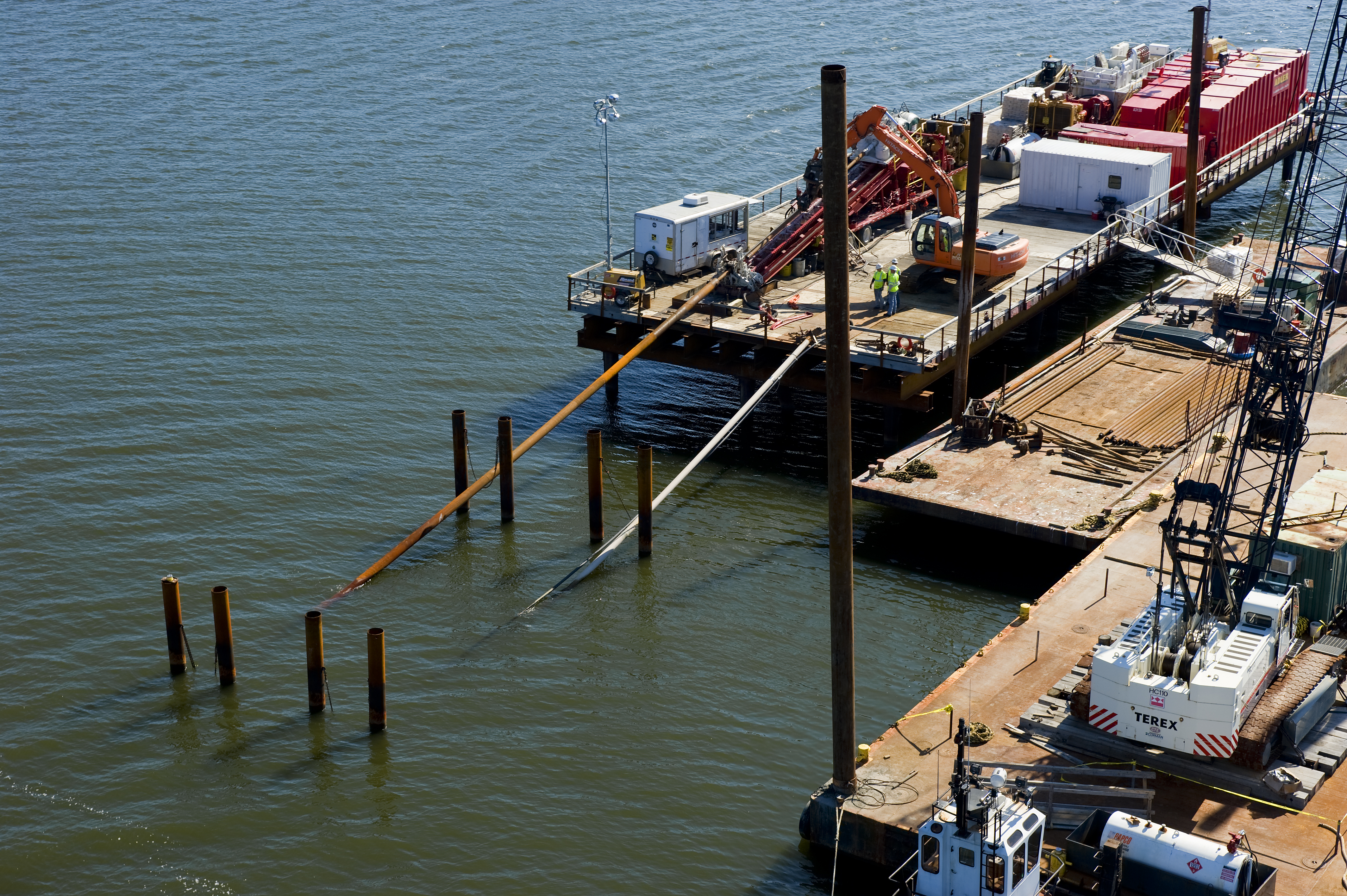
The length of the river crossing dictated that intersect drilling be used on the platform-to-platform and north shore-to-platform crossings. The platforms were stable structures in 20-25 feet of water, built to support 150 tons of equipment and supplies, and to withstand the pull loads of a 7,300-foot crossing. Barges, which are more usual in HDD shore approaches and water-to-water crossings, were ruled out due to the York River’s variable currents and 5 to 7-foot tidal surges. Corman Marine Construction provided platform construction and general marine support including tugs, cranes and divers.
Corman built 50-foot by 150-foot platforms on 90-foot pilings, and loaded and unloaded equipment and supplies, with some individual loads weighing 85,000 pounds. The platforms were built in three weeks and Corman also installed ‘goalposts’ – twin pilings, with a cross member, that supported the drill string and held it in place from the drill rigs to the river bottom.
A water source for drilling operations had to be found before work commenced. “We tested the river water,” explains Mears Project Manager Brent Curtiss, “But that water was too brackish.” On the north shore, Mears dug two temporary wells that provided enough fresh water for drilling use. South shore water was taken from a hydrant. After the shore-to-platform crossings were completed, water was pumped through the three-inch HDPE to large holding tanks that were staged on the platforms.
With the platforms in place and water supply assured, HDD operations began in February 2011.
Platform-to-shore
At 2,955 feet, the south shore crossings were the shortest of the project and the first to be completed. They were also the only non-intersect crossings. The entry points were in a high-security area next to the DVP power plant, and HDD took place with an American Augers 70,000 pounds/pullback-drill spread on land and a 330-drill spread on the marine platform.
But there were some complications even here. For one, the south shore crossing included the 45-degree bend, which wouldn’t have been a concern for the conventional open-cut dredged crossings envisioned when the ROW was acquired. But the ROW is only 120-feet wide, and since two lines were being installed offset 20-feet from each other, staying within ROW was a concern for an HDD crossing. To make it as easy as possible, Mears used a ‘racecar’ alignment.
“Basically, we started the drill path curve well before the bend, just like a racecar uses the full width of a track to start turning before it gets to curves,” explains Denis Doherty of Haley & Aldrich, who was part of the Mears design team, “This allowed us to use flatter radiuses and avoid any issues in that area.”
Steering for the crossing was done with a standard Para-Track II guidance system and 12-inch casing was installed along the first 270-feet of the curved bore path to allow enough push force to advance the bottom hole assembly along the bore path. Due to environmental concerns, downhole pressures were monitored closely to avoid inadvertent returns of drilling fluid. Drilling got off to a good start with a successful crossing and no release of fluid.
Divers helped to complete the initial phase of the first crossing by fastening a crane line to the drill string so that the string could be lifted onto the south platform. Then, the platform-based 330-drill spread worked in tandem with the shore-based 70,000 pound drill rig spread to ream the pilot hole to a final diameter of 22 inches.
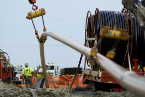
The product pipes were welded and coated as needed onshore within the power plant staging area. Pulling the product was complicated by the need to keep the main power plant road open at all times. Tie-in welds were performed during the pullback operation and both pipes were supported over the road as needed during pullback. The first crossing of the project, from south shore to south platform, was completed successfully on April 12, 2011.
Meanwhile, after the 12-inch casing was established for the south shore approach, Mears moved an American Augers rig with 140,000 pounds of pullback force and supporting equipment into location on the north shore. The north shore-to-platform crossings were 5,845 feet long with a 32-degree bend in the ROW. These were drilled as intersect crossings with the intersection point about 3,500-feet north of the platform, just on the platform side of the horizontal curve. A duel guidance system was used to achieve intersection on the north shore Line A crossing. Working from shore, Para-Track II was again used with a surface steering coil.

But passive magnetic ranging wasn’t a good solution in the York River’s main shipping channel, since large ships and barges could cause magnetic anomalies. A gyro steering tool (GST) was used instead. This system combines optical gyroscopic sensors and sensors with World Geodetic System (WGS) latitude and longitude. The two methods successfully brought the two drill bits within a few feet of each other and passive magnetic ranging was used to close the gap. With connection achieved, the drill strings were pulled back and advanced to the platform until a continuous drill string stretched from shore to platform. Two American Augers 140,000 pounds/pullback spreads then worked together to ream the desired 22-inch hole and pull the product bundle.
This completed the shore-to-platform Line A crossings. Equipment was then shifted 20-feet laterally and essentially the same procedures were implemented for the Line B crossings, except that GST wasn’t needed for the north shore intersection. Instead, a 10-gauge steering wire was run through the already installed, Line A’s, three-inch HDPE, off which Para-Track II was able to track and offset precisely.
Long crossings
Though difficult, all four shore-to-platform crossings were achieved as planned. But the 7,300 foot platform-to-platform intersect crossings were even more challenging. Not only were they extremely long for HDD water-to-water crossings, but Mears Group also had to contend with installation difficulties, an abrasive river bottom and a tropical storm that forced evacuation mid-project. But ‘unexpected’ difficulties actually are expected in projects of this size; Mears Group’s project team was well aware that challenges would arise and when they did, they reacted calmly and rose to the occasion.
Platform drilling equipment was reset by Corman Marine, using tugs, barges and cranes to position a 140-drill spread on the north platform and a 330-drill spread on the south platform, along with two 21,000-gallon holding tanks, air compressors, pipe racks, excavator and all the other equipment needed for a project of this scale. Corman also set new ‘goalposts’; two pairs of 14-inch steel pilings were set at each platform, with heavy chain draped between each pair to support casings during drilling. The casing pipe was needed to support drill pipe, and to maintain circulation of used drilling fluid without spills into the York River.
With platforms set and goalposts in place, Mears began the water-to-water crossings by installing 220-foot and 130-foot casings of 12-inch welded pipe, installed at the north and south platforms respectively. The casings were set at angles calculated to attain the designed entry angles of the drilling profiles. After drill bits were advanced 600 feet past the casings, specialized casing driver adaptors were used to add an additional 300 feet of wash-over casing to each platform’s casing string.
On the Line A platform-to-platform crossing, gyro guidance was again used to get the drill bits within a few feet of each other. But GSTs can’t detect other GSTs; therefore, the south platform drilling was put on hold while the north platform drill head was equipped with a Para-Track II guidance system. After a few ‘pass byes,’ passive magnetic ranging was used to touch bits and achieve a successful intersect.
The drill strings were now tripped back and advanced to the south platform in order to create a continuous drill string. But the north platform drill string was not able to negotiate the angle of the south platform casing. To flatten the angle and make it traversable, the south platform crew installed another 300 feet of 12-inch casing.
With a continuous, 7,300-foot drill string now created, the pilot hole could be expanded to final dimensions. The existing 12-inch casings were used as guides for the placement of new 24-inch wash-over casings, and then removed. Twenty-two-inch reamers (which expand the hole), and swabs (which clean the hole) were used successively to expand the pilot hole and prepare it for product pullback. The swab pass was timed to conclude shortly before product pullback to ensure the best possible pullback conditions.
Pilings
Meanwhile, Corman installed a series of wooden pilings to guide the steel pipe portion of the product from the north shore to the north platform. The pilings held the steel pipe in place laterally as it was pulled along the river bottom to the platform by crane barge and winch. The riverbed was more abrasive than expected and weld coatings had to be reapplied. A roller and crane were used to hoist and support the product over a local road, keeping it open for the duration of the project. The HDPE portion of the product bundle was shackled to the steel pullhead on the platform. After a 29-hour continuous pull (extended due to necessary reapplication of weld coating) the middle Line A crossing was accomplished successfully.
That left the Line B platform-to-platform as the final HDD crossing of the project. Equipment was shifted and, as with the north shore-to-platform crossing, a steering wire was run through the Line A HDPE so that Para-Track II-equipped bottom hole assemblies could successfully complete the intersect.
But then Hurricane Irene rolled in. “Fortunately, by the time Hurricane Irene reached us, it had been downgraded from a level three hurricane to a level one tropical storm,” Curtiss explains, “But we still didn’t take it lightly — there was just too much at stake.” Following the contingency plan that had been in place from the beginning of the project, shore-based equipment was chained down and all platform equipment was offloaded onto barges and pushed upriver to a sheltered inlet. The entire procedure took two days. When the storm passed, it took an additional two days to reset equipment. In total, a week was lost to Tropical Storm Irene.
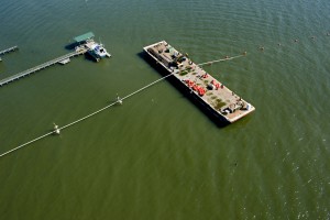
Reaming and swabbing took place as on Line A. But a new technique was employed when transporting the steel pipe from shore to the north platform. To avoid the abrasive bottom, “We came up with a method that let us float the pipe out rather than dragging it,” says Curtiss. Using a system devised by Curtiss and Prout, hundreds of crab buoys were used to support the pipe as it was towed to position.
Unfortunately, what should have been the final product pullback wasn’t quite as picturesque. Though the eight-inch steel crossed successfully, the HDPE line failed after about 5,000 feet had been pulled.
HDPE drill
The failure of the three-inch HDPE wasn’t exactly a shock, according to Curtiss; “We knew we were pushing the limits of HDPE pull back with the two long crossings,” he says, “The last one just didn’t make it. Fortunately, we had contingency plans in mind.”
Mears plan was to drill an additional pilot hole for installation of an individual two-inch HDPE line, which would be sufficient for the fiber optic line needed.
The two-inch line installation was made possible via a technique that was unlike anything Mears Group had ever attempted. After a pilot hole was drilled using the same methods described above, the two-inch HDPE wasn’t pulled back by itself. Instead, it was pulled back through the drill string, using a 3/8-inch cable and a custom-fabricated drum adapter on the north platform’s 140-drill spread. After the two-inch line crossed successfully, the drill string was removed a joint at a time by pulling toward the south platform. This was an innovative and successful conclusion to a long and challenging HDD project. The HDD portion of the DVP Transmission Project was officially completed on Dec. 15, 2011, comfortably in time for Christmas.
Because they are literally invisible, HDD crossings don’t capture the public’s imagination in the same way as skyscrapers or dams or sophisticated new bridges. But the technical achievements are just as spectacular. To cross 3.5 miles of river without disrupting the environment or shipping, and to do so on schedule and within budget, is a major infrastructure accomplishment, one that will enable the Middle Peninsula to be powered up for decades to come.
FOR MORE INFO:
Mears Group Inc. HDD Division, (281) 448-2488, www.mears.net
Haley & Aldrich, (603) 391-3309, www.HaleyAldrich.com
American Augers, (800) 324-4930, www.americanaugers.com


Comments