November 2014, Vol. 241, No. 11
Features
High-Tech Tools Have Key Place In Pipeline Routing

Extensive planning and coordination are involved in routing a pipeline. Many factors must be addressed in planning a route that incorporates landowner considerations, environmental factors and constructability issues.
Demands of a growing population and corresponding development of new natural resource areas require streamlining the routing process to achieve expedited timelines for infrastructure projects. To that end, there have been recent technological improvements in field data collection and data dissemination that shorten timelines for pipeline projects.
Before the advent of modern web-based technology, potential pipeline corridors were identified using topographic quad maps and other maps, often in paper form. During preliminary routing, these maps are used to determine the most suitable corridor. Engineers and routing coordinators consider topography, the built up environment, major crossings, and land use when selecting the route.
The maps, which were sometimes not up to date, in most cases did not show a complete picture of the changing landscape that would be encountered. Consolidating data from disparate field teams was an arduous process. Synchronizing efforts along a proposed corridor involved significant hours of processing field drawings, document scanning and office work. This disjointed workflow created inefficiencies and often resulted in duplicate data, revisits to the field and a slowdown in key project delivery. As a result, the schedule and cost were affected.
With the arrival of mobile tablets, cloud servers, web maps, GIS data, free aerial imagery, and 4G connectivity, the basic tools were in place to produce a common operating picture for reporting, data collection and data management. Even with the availability of these tools, many field-to-office systems still lack the ability to synchronize data in real time. While the technology exists, an understanding of how to move beyond spreadsheets and into data bases takes true expertise.
Making data bases transactional, and synchronizing them in real time between the field and office, is the best way to squeeze value out of an investment in this technology.
A Project Overview
Rockies Express Pipeline (REX), which Tallgrass Development, through its wholly owned subsidiaries operates and holds 50% interest, implemented a feasibility study for a loop to the REX 42-inch pipeline along 300 miles in Ohio and eastern Indiana.
REX chose CH2M HILL’s OmniSight Platform to find a constructible route, and to serve as the data clearinghouse for all field data from biological, cultural and land consultants. OmniSight is a data platform that connects systems in real time.
Four teams were deployed to the field as part of the project: land agents, construction managers, biologists and archaeologists. All field teams were given access to the field software.
The land management system resided in a legacy back-office system. Using custom tools available on the OmniSight Platform, this data was synchronized to the distributed GIS system in real time. If a land agent was to make a change on the parcel status (reflected as a color change), these changes would immediately show up on the mobile device for other field staff evaluating the route for environmental and constructability considerations. This way the entire project team worked in real time and the client was able to view the progress in real time.

Using a parcel-based approach allowed the project to progress seamlessly through all phases of the routing process with land agents signal access prompting biological and cultural teams to perform their survey. If either the biologists or archaeologists found an environmental constraint meriting a re-route, they could collaborate in real time via the mobile software with construction managers.
The pipeline could be mobilized, scouted, and routed in a matter of weeks rather than months. A common operating picture was accessible on a web map interface and mobile interface that allowed for simultaneous and centralized land acquisition management, along with biological and cultural survey display. This single warehouse for project progress and operation allowed for clearer remote communication for the client’s management of field teams and data.
Basemap Development
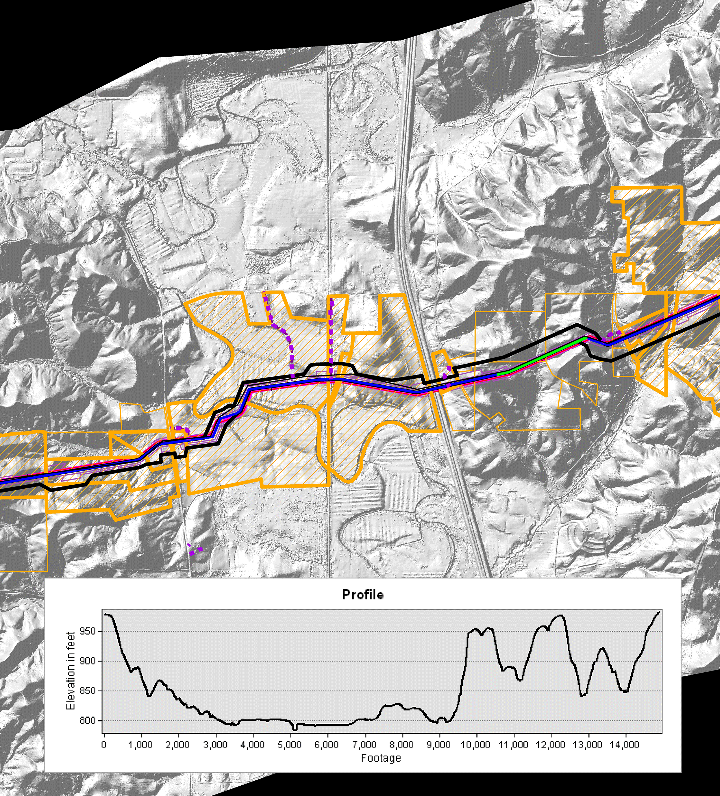
Before the field deployment, CH2M HILL was able to acquire, process, and serve 1-foot color aerial imagery, and light detection and ranging (LiDAR)-derived topographic maps within a healthy buffer of the project to assist in field reconnaissance effort.
Draft-level pipeline crossing data for roads, rivers, streams, overhead utilities, buried utilities and existing pipeline crossings was automatically processed via crowd-sourced open street map (OSM) data feed.
This allowed the team to paint a true picture of the surface before boots hit the ground, which was good from a safety standpoint. The combination of color imagery, LiDAR and draft feature data served as the mosaic backdrop to the project basemap. This basemap was then used to create the web map and mobile components.
Result: Faster Decisions
Quicker decision-making was possible because land agents, the field constructability team, and biological and cultural teams all had access to the same dynamic map. Because all current data was available to all the appropriate people as soon as it was updated, the effort no longer moved through slower, disjointed phases of ownership between the teams. For example, a land agent could report that a parcel had permission to survey, and email notification would immediately be sent to other team members.
A project’s workflow need not only be associated with a GIS system, or any other back-office data management system, for that matter. The OmniSight Platform can be integrated into other back office system, including SharePoint, Amazon S3 storage, Excel, Informix, NetSuite, ODBC, OLE DB, SQL, DB2, OpenAir, QuickBooks, Sage, Salesforce, SAS, SugarCRM, Sybase, Teradata, ArcGIS, Oracle, PODS and Microsoft Dynamics CRM.

Author:
Alex Mahrou is mobile practice lead at CH2M HILL Oil, Gas and Chemicals Group where he manages mobile data capture and data display for pipelines, including preliminary routing, right-of-way, construction management and inspection. He also specializes in data automation and cloud integration of the OmniSight product.


Comments