
April 2022, Vol. 249, No. 4
Tech Notes
Advanced Cameras Measure Infrared Absorption from Methane
By Robert Ward, Vice President, Business Development, Kuva Systems
With ESG (environmental, social, governance) being today’s hot three-letter acronym, the industry is clearly focused on re-establishing itself as a clean-capable energy provider. Kuva Systems, like several others, have pulled out all the stops to accelerate innovation to help operators achieve their ESG and methane-intensity goals.
Aerial surveys have increased in frequency, and, increasingly, websites are publishing those findings, resulting in the proverbial “target on my back.”
Currently, there are at least five providers of such services: Kairos Aerospace, Bridger Photonics, Carbon Mapper, Ghost Data.Air and Champion/Scientific Aviation. The new U.S. Environmental Protection Agency (EPA) rules will make aerial surveys routine, and the only way to get ahead of it is with continuous monitoring.
As many operators work toward Scope-1 goals by changing to low-bleed equipment alternatives, or eliminating the use of natural gas-powered instruments altogether, they now face the daunting task of mitigation of releases created by operational abnormalities. These are episodic in nature and have little to no predictability, but they have the potential to cause significant releases.
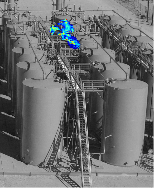
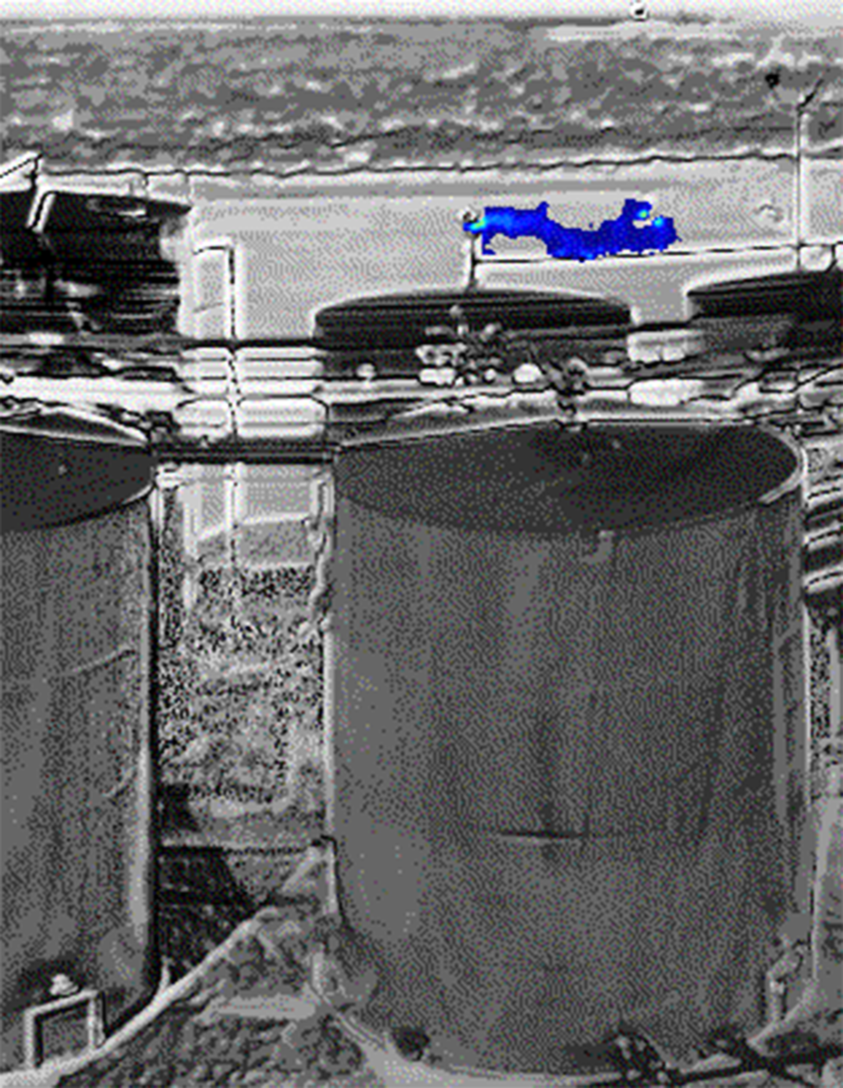
I must admit that when we first deployed cameras in the Delaware Basin in 2021, I anticipated identifying leaks around flanges, valve bodies, compressors, etc. Within minutes of being online, we were seeing gas flows from latched thief hatches, Elnardo valves, and vapor recovery unit (VRU) feed lines. These leaks were the sorts that you would find posted by the Environmental Defense Fund (EDF), Carbon Mapper and others, and on multiple occasions were missed by local networks of point sensors (Figure 1).
We’ve learned that you can’t fix what you can’t see, so what better way to address emissions mitigation than providing alerts that provide an image consisting of a colorized gas plume along with the process equipment so the operator can see what is leaking without having to visit the site for a manual optical gas imaging (OGI) inspection. We refer to this endearingly as continuous-OGI.
Kuva entered this space six years ago developing a shortwave infrared (SWIR) camera that uses a non-thermal (not FLIR-like) sensor to create this image. Instead of measuring temperature differentials, it measures the specific absorption of infrared (IR) in the air from methane and volatile organic compounds (VOCs).
These images are processed in the camera’s edge computer and then sent to the cloud for further validation, assuring zero false positives. The images are then made available to the operator for intervention.
The camera has a range of 165 feet (50 meters) and with its integrated pan-stage can rotate 360 degrees, allowing the user to select multiple fields of view, many times providing visibility of the entire facility (Figure 2).
Just recently an operator was able to intervene on a malfunctioning flare where the pilot state being monitored in supervisory control and data acquisition (SCADA) contrasted with our camera image.
Once on-site, it was determined that the pilot was indeed lit but the flare had blown out and continued to flow gas to the atmosphere. That was an unusual application since most would suspect that the pilot ignition state will be the same as the flare state, but that’s not always the case.
Unlike continuous point sensors that are known to provide nuisance alarms causing a truck roll with a handheld OGI, these alerts are accompanied using an image that is actionable because it shows what equipment causes emissions.

Comments